
The Andhra Pradesh Government has approved the VMRDA Master Plan 2041, a long-term urban development blueprint covering 4,380 sq. km across Visakhapatnam, Anakapalle, and Vizianagaram districts. The plan focuses on sustainable urban growth by improving transport infrastructure, expanding industrial and IT zones, strengthening connectivity to Bhogapuram International Airport, developing metro rail corridors, enhancing road networks, and promoting economic growth across the Visakhapatnam Metropolitan Region.
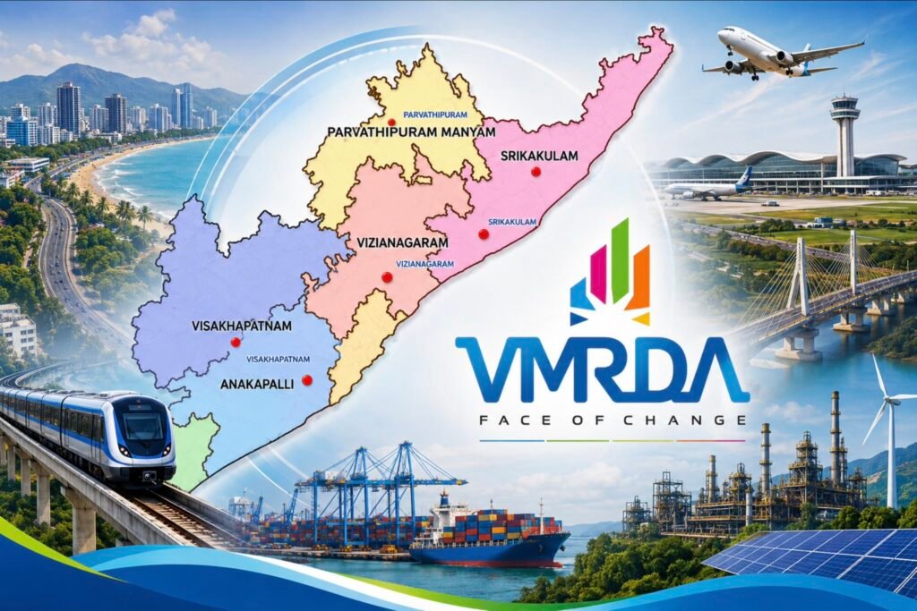
VMRDA Master Plan 2041 Approved: A New Vision for the Visakhapatnam Metropolitan Region
The Andhra Pradesh Government has officially approved the VMRDA Master Plan 2041, paving the way for the long-term development of the Visakhapatnam Metropolitan Region (VMR). Covering nearly 4,380 square kilometres, the master plan spans Visakhapatnam, Anakapalle, and Vizianagaram districts and is designed to guide urban growth over the next two decades.
The approval marks a significant step toward creating a modern, sustainable, and globally competitive metropolitan region in North Andhra.
What is the VMRDA Master Plan 2041?
The VMRDA Master Plan 2041 is a comprehensive urban planning framework that outlines future land use, transportation, infrastructure, industrial development, housing, and environmental conservation across the Visakhapatnam Metropolitan Region.
The updated plan aims to accommodate future population growth while improving connectivity, economic opportunities, and quality of life.
Key Highlights of the Master Plan
Bhogapuram International Airport Connectivity
One of the major priorities of the plan is strengthening connectivity to the upcoming Bhogapuram International Airport through improved road infrastructure and integrated transport networks.
Metro Rail Corridors
The master plan includes the development of metro rail corridors to improve public transportation and reduce traffic congestion across the metropolitan region.
Expansion of Road Networks
Several existing roads will be widened, and new corridors will be developed to improve connectivity between urban centres, industrial zones, and residential areas.
Coastal Corridor Development
The plan proposes the development of coastal corridors to improve tourism, mobility, and economic activity along the Visakhapatnam coastline.
IT Parks and Data Centres
To position Visakhapatnam as a leading technology destination, the master plan encourages the expansion of IT parks, data centres, and digital infrastructure, attracting new investments and employment opportunities.
Industrial and Logistics Growth
The plan also identifies new industrial and logistics zones to support manufacturing, exports, warehousing, and port-based industries, strengthening North Andhra’s economy.
Districts Covered
The approved VMRDA Master Plan 2041 covers:
- Visakhapatnam District
- Anakapalle District
- Vizianagaram District
Together, these districts form one of Andhra Pradesh’s fastest-growing metropolitan regions.
Why This Plan Matters
The approval of the VMRDA Master Plan 2041 provides a clear roadmap for balanced urban expansion while protecting environmental resources. It is expected to:
- Improve transportation infrastructure
- Enhance regional connectivity
- Generate employment opportunities
- Attract domestic and international investments
- Support IT, industrial, and logistics sectors
- Promote sustainable urban development
- Strengthen Visakhapatnam’s position as an economic hub of Andhra Pradesh
With infrastructure projects such as Bhogapuram International Airport, metro rail, coastal corridors, and new industrial zones progressing simultaneously, the Visakhapatnam Metropolitan Region is expected to witness significant growth over the coming years.
The approval of the VMRDA Master Plan 2041 represents a major milestone in shaping the future of North Andhra and transforming the region into a world-class destination for business, investment, and urban living.
Do follow @vizag_tv for more Vizag updates.
FAQ
What is the VMRDA Master Plan 2041?
It is a long-term urban development plan for the Visakhapatnam Metropolitan Region covering infrastructure, transport, housing, industries, and land use until 2041.
How much area does the plan cover?
The master plan covers approximately 4,380 square kilometres.
Which districts are included?
Visakhapatnam, Anakapalle, and Vizianagaram districts.
What are the major infrastructure projects included?
Bhogapuram Airport connectivity, metro rail corridors, road expansion, coastal corridor development, IT parks, data centres, and industrial logistics hubs.
Why is the plan important?
It provides a long-term roadmap for sustainable urban growth, improved connectivity, increased investment, and economic development across North Andhra.